
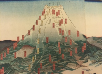
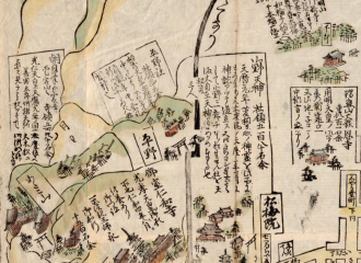
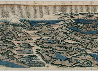
Fuji ryōdō ichiran no zu
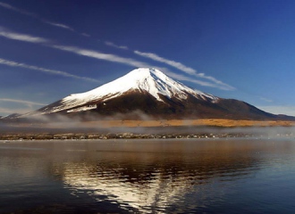
The title of the map, Fuji ryōdō ichiran no zu 富士両道一覧之図, literally means “the illustration of the two paths of Mount Fuji”. The height of Mount Fuji is 3776 meters which equals to approximately 12,389 ft. It is the highest mountain in Japan. The location of Mount Fuji is in between Shizuoka Prefecture and Yamanashi…


You must be logged in to post a comment.