
Bankoku Sōzu


Click here to view these images in the UBC maps collection.
What is Bankoku Sōzu?
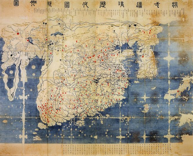
Bankoku Sōzu (complete maps of the people of the world) is the oldest Japanese map of the Tokugawa era collection. One side of this map depicts a colourful world map indicating different countries and continents. The other side of the map displays diverse ethnicities from around the world and labeled with their names and small explanations. The map triggers a viewer’s curiosity since it does not only include the real countries such as Portugal or Netherland but also the imaginary places like Dwarves and Giants. This double-sided map is one of the most significant Japanese historical texts as it exemplifies a cartographic influence of European countries and China and represents how Japanese has interacted with foreign nations around 17th centuries.
Our Question?
Japan was isolative when it comes to the politics and geographical sense around this period. By looking at this map, it is quite interesting to think how the Japanese people could have had known so much about outside of their island and started taking an interest in the other countries. For these reasons, in this post, we will analyze how the foreign nations have influenced the cartography in Japan and contributed to the creation of Bankoku Sōzu.

Historical Background of Tokugawa Era?
Before we jump into the deeper look of the international relations in Japan, I would like to first introduce the characteristics of the Tokugawa era. Tokugawa era is also known as Edo period between 1600s – late 1800s in the history of Japan. Around this period, Japan was under the rule of Tokugawa shogunate and regional daimyos. The society has a very isolative foreign policy which was an inherited perspective from the predecessor, Toyotomi Hideyoshi, who was suspicious about foreign cultures (Lu, 191). In particular, when Portuguese introduced the Christianity to the Japanese, the government were not willing to accept this exotic concept. Since the main idea of the Christianity was equality, it might disintegrate the social system and the government. However, based on the historical record, there actually was a rebellion against the oppression by the feudal lords in Shimabara around 1630s (Joseph, 1979). For this reason, as the government wanted to prevent their society from any potential disintegration, Portuguese and other Christian activities have started to be perceived as threats to the establishment of loyalty to Tokugawa clan. These have led to the persecutions against any Portuguese missionaries and the government has further initiated isolative policies against any foreign contacts including heavy taxations on the trading In particular, based on Arano’s research, “[the Dutch] was charged rent for their lodgings in their designated compounds and were required to pay a variety of taxes and other charges on incoming and outgoing cargo” as well (2013).
.

Selective Foreign (Dutch) Policies
Within these multiple restrictions, how the Japanese people have gained such extensive knowledge on the outside world? The answer could be found in the Japanese government’s selective interactions. In particular, foreigners were only allowed to stay in Nagasaki area under the inspection of local government. For instance, the government has created an artificial island named Dejima in order to accept the Portuguese missionaries. According to Marius, after the uprising in Shimabara, this artificial island was inherited only by the Dutch (2002).

Although the artists of this map are unknown, considering that it was made in Nagasaki, it is possible to understand that this oldest map of Tokugawa era was created based on the knowledge of Europeans (especially Dutch) who have traveled around the world. Furthermore, Japan has frequently had a contact with them by sending their government officers and started learning about practical knowledge. They have further sent the scholars called “Rangakusha” to them and translated the Dutch scholarly books in the area of medicine, mathematics and physics (Cryns, 2005). Since Dutch has mainly aimed for gaining financial benefit throughout the trade, they were able to attain a differentiated treatment contrary to Portuguese. This has led for Dutch to maintain a continuous and exclusive relationship with this isolated Japanese government. As a result, this outstanding Western knowledge has contributed to the development of Japanese culture and further influenced the views of Japan towards the global nations.

Chinese Influence
With this diverse access to the new geographical sources and subject introduced by these European traders, the Japanese people have tended to address these exotic concepts with a combination of art pieces. China, in this case, has shown the pathways to display these arts with their pictorial ideas. In particular, Matteo Ricci, who was born in Italy and sent to Beijing as Jesuit priest, has contributed the most when it comes to the development of cartography in Japanese history. Based on the historical context, “Matteo Ricci, a Jesuit missionary working in China, may have had an influence in shaping Edo period mapping and an emerging Japanese world view in ways that he and no one else at that time could have imagined” (Loh, 178). One of his most representative maps, “A Map of Myriad Countries of the World” is visually associated with the making of Bankoku Sōzu. For instance, the shapes and the arrangements of some continents depicted in this map resembles Bankoku Sōzu’s.

Around this period, the Chinese dynasties have been obsessed with the idea of “Sino-centralism” and this has further created their world-view. The Chinese people have considered themselves as the centre of the world and the others as just the countryside of their continent. This perspective has further influenced their art piece including the maps.
From the historical context, Chosun dynasty has maintained a tributary system to Chinese kingdoms and frequently interacted with them when it comes to the cultural norms. Corresponding to this theory, Chosun has created a map called “Gangnido” that the Chinese continent is located at the centre of the map. According to Bae, since Sinocentrism was the primary principle that regulated the daily lives of [Chosun] people, they viewed the world through the prism of Sinocentrism” (73). However, Matteo Ricci had ambitions that he could use the map to impress the Chinese and convince them of the superiority of Western civilization and their glorious Christian culture (Loh, 2013). His eagerness to change this idea of Sinocentrism could be identified in this map (A Map of Myriad Countries of the World) as he did not care the location of the Chinese continent in the map.

Bankoku Sōzu is one of the most significant examples which have been influenced by the Chinese and Matteo Ricci’s cartographic style. In particular, both of Matteo Ricci’s map and Bankoku Sōzu use same characters “萬國” which means ten thousands countries and also stands for all of the countries in the world. Furthermore, the alignment and placement of the lands and oceans are parallel. These similarities represent that the Japanese and Chinese cartographic style have shared same world-view in a making of the map. As a result, we are able to identify that the Western concepts of the geography was influential to the Japanese cartography after the maps created by Matteo Ricci were introduced.
Conclusion
Although the Dutch was the only country allowed to stay in Japan as and do business as a Western civilization, the Japanese has not underestimated the presence of other foreign nations. By including all the nations that they have known and been informed through the knowledge from outside of the island into the art piece, Japan has started notifying the power of Western civilization and planning to learn it as well. As the early part of the post has mentioned that the Japanese government has stood a quite defensive and isolated position towards the other foreign countries during Edo period, they have initiated some restrictions on the interactions such as imposing a heavy tax or creating a high barrier to trade. However, when we carefully look at the maps of Tokugawa collection, we could find out many of their cultural aspects have been influenced by the foreign ideas. In order to not fall behind the other nations when it comes to the knowledge and cultures, they have tried their best to accommodate the others by protecting their sovereignty from any potential threats. Consequently, if we go back to the main question of this post that how come the Japanese people were able to achieve this Western knowledge and create this map called Bankoku Sozu when they were having an isolative stance against the other exotic nations, the answer could be the Dutch and Chinese influence in terms of the foreign knowledge and cartography.
Works Cited
Arano, Yasunori. “Foreign Relations in Early Modern Japan: Exploding the Myth of National Seclusion.” Nippon.com. October 28, 2014. Accessed April 23, 2018. https://www.nippon.com/en/features/c00104/.
Bae, Sung Woo. “Joseon Maps and East Asia.” Korea Journal 48, no. 1 (April 01, 2008).
Cryns, Frederik. “Translation of Western Embryological Thought in the Edo Period: Tsuboi Shindō and Malpighi’s Observations of Fertilized Eggs.” Japan Review, no. 17 (2005): 55-89. http://www.jstor.org.ezproxy.library.ubc.ca/stable/25791291.
Jansen, Marius B.. Making of Modern Japan. Cambridge: Harvard University Press, 2002. Accessed April 23, 2018. ProQuest Ebook Central.
SEBES, Joseph. “Christian Influences on the Shimabara Rebellion 1637-1638.” Archivum Historicum Societatis Iesu 48, (1979): 136. http://ezproxy.library.ubc.ca/login?url=https://search-proquest-com.ezproxy.library.ubc.ca/docview/1299708193?accountid=14656.
Loh, Joseph F. “When Worlds Collide—Art, Cartography, and Japanese Nanban World Map Screens.” Order No. 3548112, Columbia University, 2013. http://ezproxy.library.ubc.ca/login?url=https://search-proquest-com.ezproxy.library.ubc.ca/docview/1282129281?accountid=14656.
Lu, David J. Japan: A Documentary History: V. 1: The Dawn of History to the Late Eighteenth Century. 2nd ed. New York: Routledge, 1996. 191
[Unknown]. 2018. M. Japanese Maps of the Tokugawa Era. [Nagasaki? : publisher not identified]. Accessed April 18. doi:http://dx.doi.org/10.14288/1.0213137.

You must be logged in to post a comment.